Since this spring, Henry has loved maps and all things geography. He has a small globe that he often just carries around pointing out continents and various countries. At the time, I was unprepared in the classroom. So, I've been working hard to fulfill the geography void. Our Montessori geography work includes --
This post contains affiliate links at no cost to you.
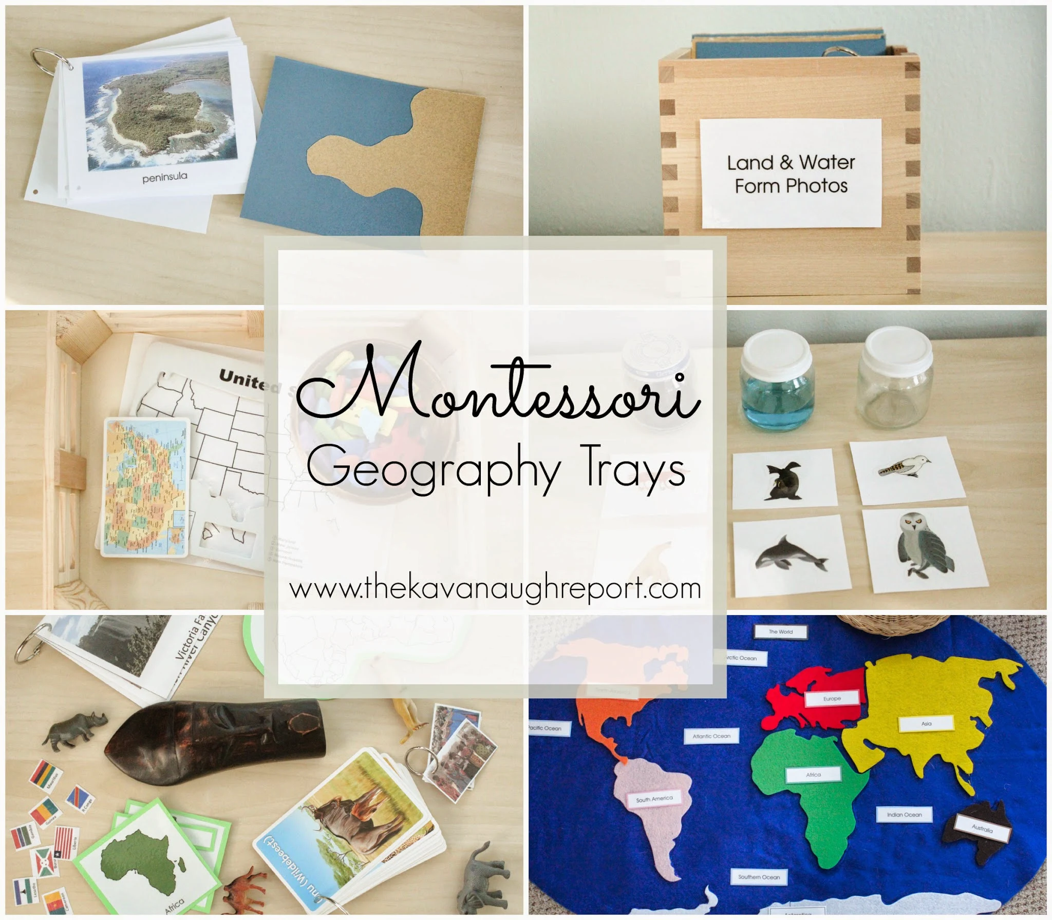
U.S. Puzzle Map -- this is not the nicest puzzle, but it's what we have right now. It was from a $1 bin at an office supply store. I'm hoping to get a true Montessori puzzle map for Henry for Christmas.
This tray includes a small card listing all the states, a blank control map, and the foam puzzle. Henry uses this every single day. Sometimes he just asks me to read the list of all the states' names over and over.
Continent Boxes -- I have a "box" for each continent (actually a box for two, and bags for the rest since Ikea was sold out last time we went -- hopefully will have the rest of the boxes soon). The box contains pictures of places, people, and animals from each continent, flags from each continent, a map of the continent including countries, and small trinkets from the continent.
Land and Water Formations -- These cards help Henry identify different geographical land and water formations like island, lake, peninsula and straight. The cards, I made myself by cutting sandpaper and gluing it to card stock.
The small booklet contains real pictures of the formations and their definitions. This came from Montessori Print Shop and was included in the Montessori at Home eBook and Printables bundle. Eventually, I hope to expand on this work further, by having tray that Henry can build the formation and pour water into.
Land, Air, or Water -- This basket includes 3 jars, one with water, one with nothing and one with dirt. They obviously represent three major elements found on the Earth's surface. With the jars, I have included small animal cards to sort between the elements -- into which animals use the air, the seas and the land. The cards were made using these beautiful stickers featuring images found in Inuit art.
This is another popular work with Henry. One of the jars has has a different lid because it was accidentally broken at co-op before I could take a picture. It's been too cold to spray paint the new lid, so this has to do for now.
Felt World Map -- This map was made using the beautiful pattern that was so generously made by Stephanie at Imagine Our Life. Her map is about 10,000 times more beautiful than mine and worth checking out!
I made mine slightly different than Stephanie -- using stiffened felt for the continents, blue-on-blue for the control and stitching a matching outline around each. This is another work that Henry uses on a daily basis. He loves placing all the continents, their labels and animals on the map. I'm hoping to add some of these world landmark figures soon!
Me and My World Book -- this book is meant to help Henry see his place in the larger world. He was having a hard time understanding that he lived on a continent, in a country and in a state all at once.
And that's it! Do you have any suggestions for me to add? Or do you have a geography obsessed child?
If you liked this post, don't miss: Montessori Inspired Space Theme; Zones of the Ocean for Preschoolers with Printable


